
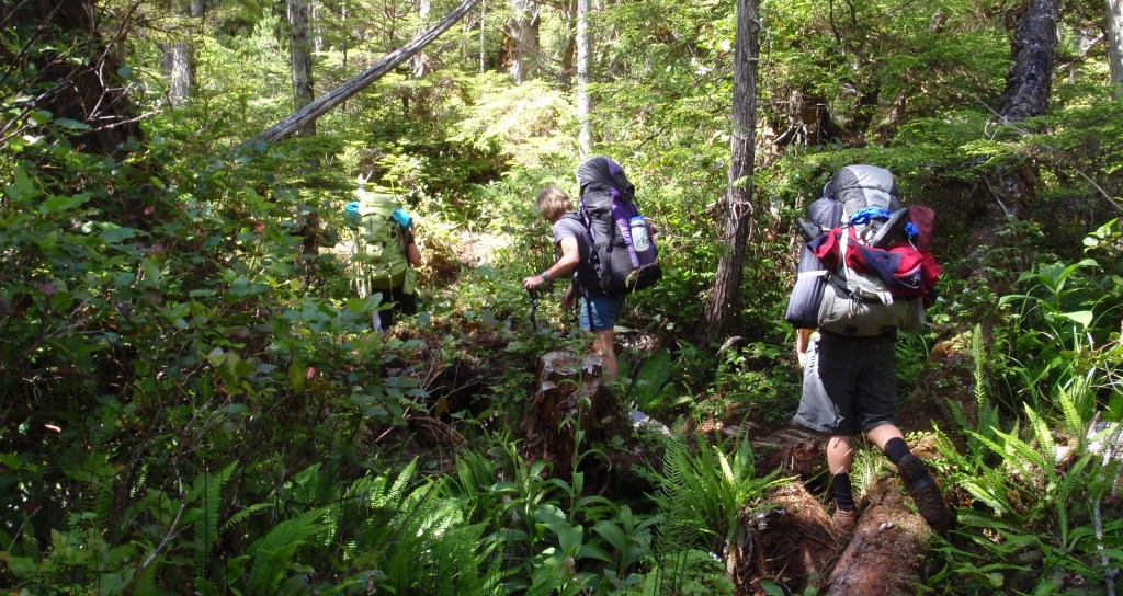
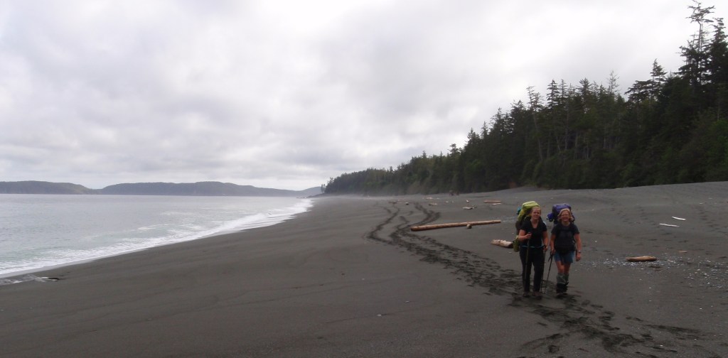
A subject dear to my heart is the time we’ve spent hiking our beautiful coastline. From the rugged Juan de Fuca Trail in the south to endless beaches of the Naikoon way up north in Haida Gwaii, our coastal trails are a gateway to magical places that offer a unique and profound connection with nature. We’ve been very fortunate to have walked all the multiday, coastal hikes (8 in total) of our province…….or at least, we think so. If you know of any others, let us know!
Walking the coast creates an indelible sense of place, as close to a spiritual connection to the land as I’ve ever felt. The verdant forests of towering spruce and craggy ancient cedars, the wind-battered shore pines, rocky headlands and their impregnable understory, the cathedral-like sanctuaries of calm just a few dozen meters in from high water with huge trees, dripping lichens, epiphytes and deep moss underfoot.
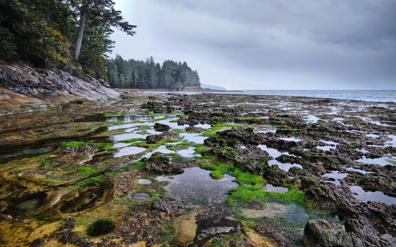
Driftwood laden beaches of every conceivable walking surface. The incredibly rich intertidal zone and the equally diverse aquatic environment just offshore, the abundant animal and bird life, the often tempestuous weather and the power of the ocean it fosters all create an unforgettable experience. On top of all this, is the often difficult to discern, but often ‘sensed’, imprint of thousands of years of Indigenous presence on the coast.
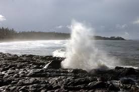
For the most part coastal BC is exceptionally rugged and difficult to access. A few of the coastline trails are accessed by road and others can only be reached by plane or boat. In general, the more difficult the access, the fewer the visitors. In my view (tainted, I’m sure, by my enochlophobia ! )the more remote, the more aesthetic the experience.
The following is a series of personal anecdotes of some stand-out memories from these diverse trails. It is by no means a guide to undertaking any of these hikes but hopefully serves as inspiration to do so. Note: The years (in brackets) indicate when I/we visited.
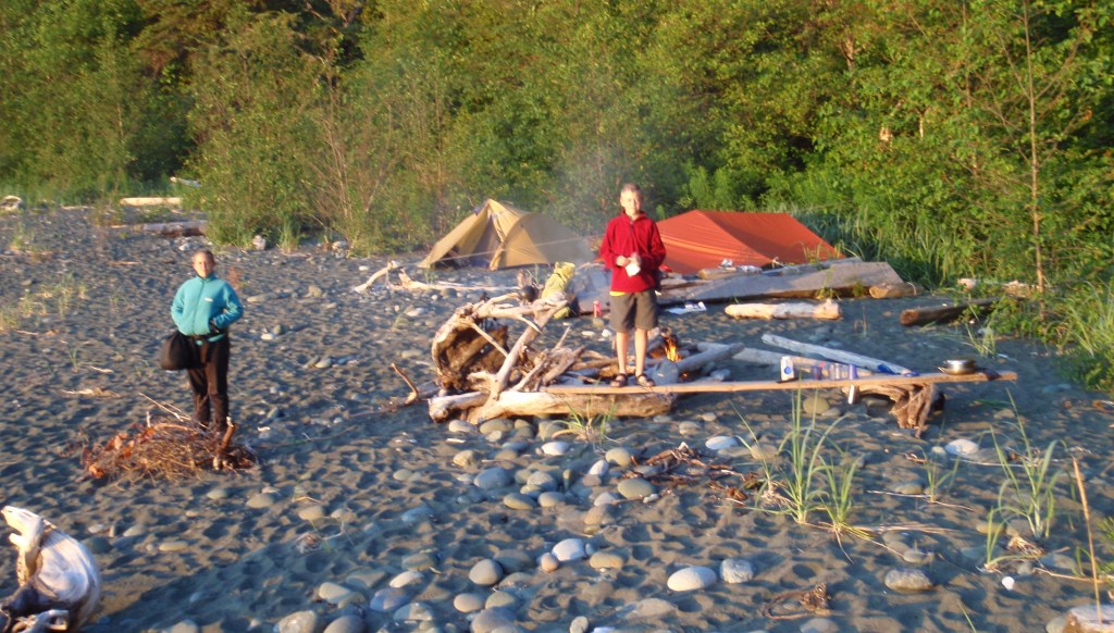
The West Coast Trail (1973, 1974, 1976)
This iconic trail hardly needs introduction. Built in 1907 as a life saving response to the frequent shipwrecks that occurred along this stretch of coast (Graveyard of the Pacific), it has become one of the most famous hiking trails in Canada. From beautiful Pacheena Bay in the north to Port Renfrew at its southern terminus, the 80+ km trail offers the full spectrum of coastal environments, obstacles and attractions. Lighthouses, waterfalls, driftwood strewn beaches of every type, rickety ladders, slippery boardwalks, self-propelled cable cars, magnificent old growth forest, and of course, mud, roots and unpredictable coastal weather. Despite the many upgrades over the years, it remains a challenging hike.
However, when we first did the hike, in 1973, it was a much different undertaking. The trail had only just received designation as a Park.
Regrettably, my memories are, to say the least, vague. I can’t remember how we got to the trail head nor returned from the more remote, trail end at Pacheena Bay (probably hitch-hiked). I was the trip organizer, only 18 at the time, and was joined on the hike by my older sister Ella, best buddy Pete and Carol, a hoped for, girlfriend-to-be. We were inexperienced and poorly equipped. We didn’t even have a stove, relying on fires for cooking, always a fraught experience in the rain.
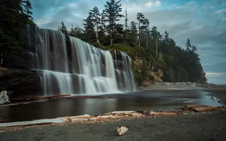
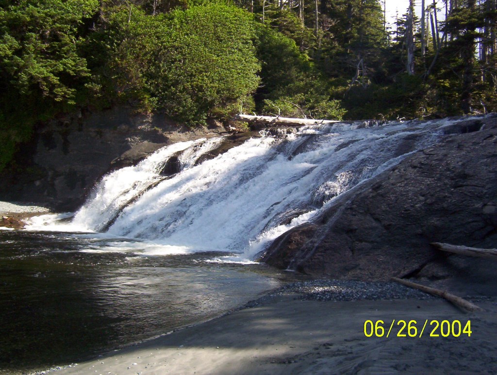
Tsusiat Falls tumbling directly onto the beach is one of the standout features of the WCT. (photo credit: Happiest Outdoors)
In the six or seven days we were on the trail we encountered only a handful of other hikers. In contrast, Parks Canada now has a reservation system to limit the number of hikers to 70 per day.
In those days, river crossings were a challenge. There were no cable cars and rivers were either waded or forded on questionable rafts of driftwood bound together with flotsam twine.
In the following years I did the trail a couple more times. Once with brother Dave and Margaret, another, short-lived girlfriend (seems like my idea of fun doesn’t appeal to everyone!). Dave’s future in the commercial fishing industry seemed pre-destined as he reeled in Dungeness crabs that he would snag in the shallow estuaries. Ignorant of PSP (Paralytic Shellfish Poisoning) at the time, we consumed lots of mussels to no ill effect. They’ve since become a staple of every coastal hike. To test for PSP, I’ve heard that the natives wait to see if the seagulls will eat an opened offering but my, probably highly questionable, method of tasting a small portion then waiting 30 minutes, seems to work for me (don’t try this at home!).
Cape Scott Trail (1975)
In the 70’s, whenever I had the chance, which was quite often given my sporadic interest in working for a living, I continued to explore the outer coast of the Island. Cape Scott, the northern most tip of the Island was intriguing not just for its remoteness but also for its history. Two failed settlement attempts, first by the Danes at the turn of the previous century and then another a few decades later, have left some remnants of past attempts to tame the land, most of which have long since succumbed to nature. My first trip to the Cape was a solitary one, accompanied only by a dog I’d adopted. ‘Space’ was his name, a beautiful Samoyed, not particularly bright nor well trained but with many endearing qualities. Howling, in time, to the music of the Rolling Stones was one of those.
I had driven to the trail head in my indestructible, 1961 Valiant V200. It was a long, rough dirt road from Port Hardy that saw little non-commercial traffic in those days. I’ll never forget coming around a corner to see a giant, Hayes Clipper logging truck bearing down on me. With their oversized load, forced to stay in the center of the road and slow to brake, I pulled over into the ditch and nervously watched as the truck bed went over the roof of my car.
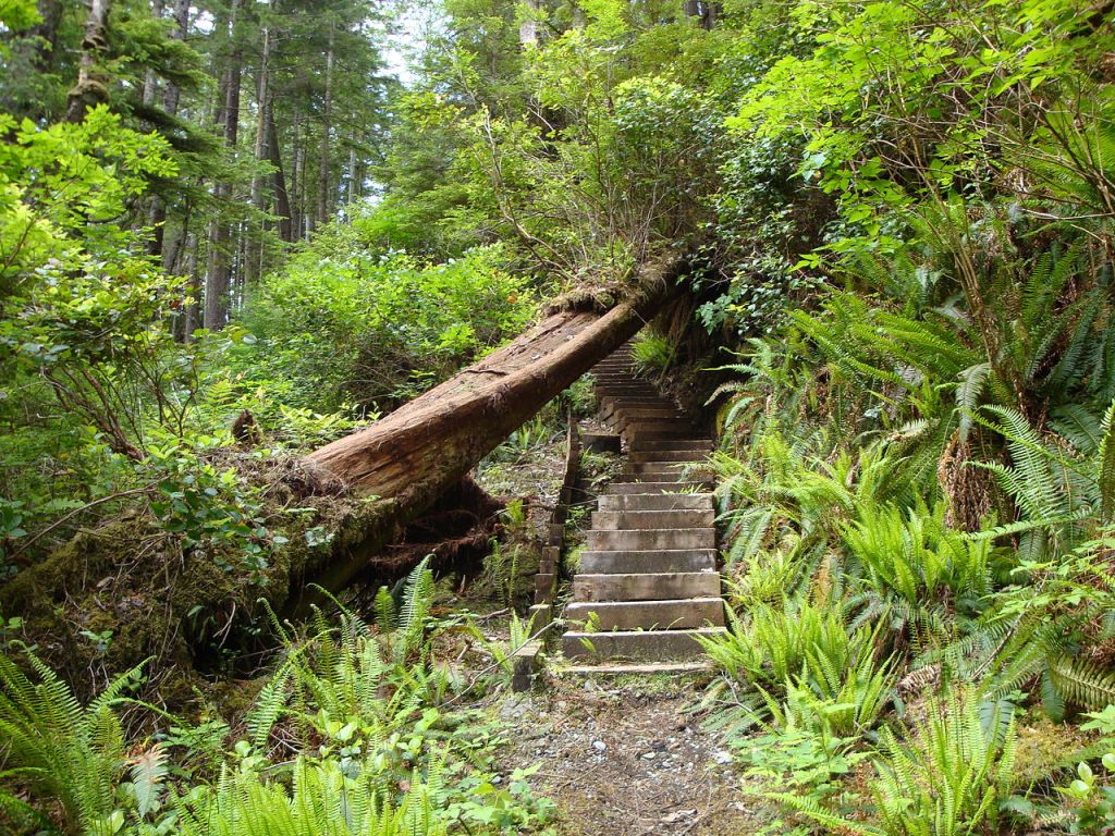
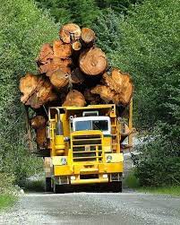
(Left) Remnants of the past quickly succumb to nature. (Right) An ‘off-road’ logging truck!
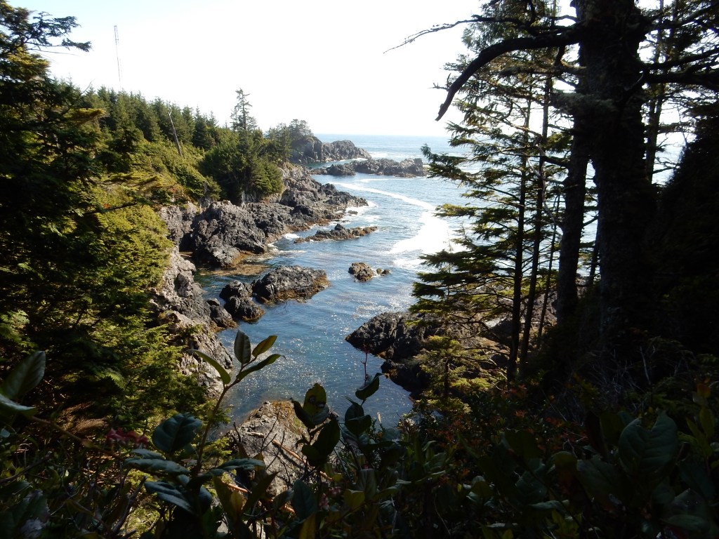
In those days, the trail in to the Cape from San Josef Bay (25 km) was exceptionally muddy and through dense, gloomy forest and often swampy, flat terrain. No wonder the Danes had trouble getting their produce to market and the resulting demise of their colonies. As one approaches the coast however the many splendors of the rugged coast, broken by beautiful sand beaches, makes the muddy slog well worth it.
Beautiful Nissen Bight (Photo credit: Leigh Macadam)
Exploring first towards the east, the trail broke out of the forest onto Nissen Bight and there much to my surprise and high up on the beach, was a tattered looking, commercial fish boat lying on its side. The smell from a hold full of rotting halibut took some time getting used to but once up on the bridge amongst all the abandoned electronic equipment (radios, depth sounders, radar, etc.) and after convincing myself about my marine salvage rights, dreams of easy money floated in my head. I got out my hatchet and managed to free the equipment from their mounts, wrapped it all in plastic and then buried my electronic treasure amongst the mounded driftwood up against the forest, with every intention of returning to my valuable cache later. Afterward: A week later, once back in Port Hardy, I asked some fisherman in the local bar what the market for such, ‘hypothetical’ equipment might be. They laughed at my naivete and informed me that such equipment, once exposed to salt water, was toast!
The next few days I slowly worked my way westward towards the storm-tossed Cape itself and its famous lighthouse. While camped at Nels Bight, a perfect 2.4 km stretch of wild beach, I built my first beach sauna. Using an old tarp I found up amongst the driftwood I built a small igloo-like affair on the beach. A big bonfire served to heat up some close-grained, granite rocks which I then dragged into my shelter. Once inside, with the tarp pulled tight, I carefully dripped water onto the red-hot rocks. Twenty minutes later, drenched in sweat I ran naked into the cold, ocean waves. Two more spells in my rustic sauna and back into the ocean left me clean, physically drained and elated. This was the start of a long tradition of building beach saunas whenever I could.
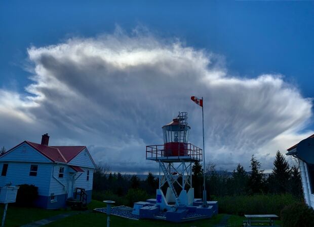
The humble Cape Scott lighthouse, one of the few BC coast lighthouses still manned to this day, with storm clouds brewing overhead. (Photo credit: Harvey Humchitt Jr.)
As we worked our way westward, I found the trail to the lighthouse closed, so I backtracked and decided to try to work my way along the wild, north coast to the lighthouse, with the intention of claiming ignorance of the trail closure upon arrival. Traversing rocky shelfs, tide permitting or fighting my way through the salal over headlands on faint game trails can be tough going. At one pocket beach, Space (my canine companion), dropped down through the brush in front of me startling a big, black bear on the beach. He immediately charged towards the bear but my piercing yell had him freeze, giving the bear room and time to flee. Dogs are often the reason behind human–bear conflicts but fortunately, listening to my command that instance was a first for ol’ Spacer.
Not easy going!
The spectacular beaches, abundant wildlife, rocky headlands and a visit to the Cape itself plus the remnants of the Danish settlement at the Cape all make for a memorable location well worth the muddy slog and remote access. N.B.- We were to find out, many years later when finishing the North Coast trail (that shares a portion of the Cape Scott Trail), that much of the trail to the coast has now been board-walked. The muddy slog now a thing of the past.
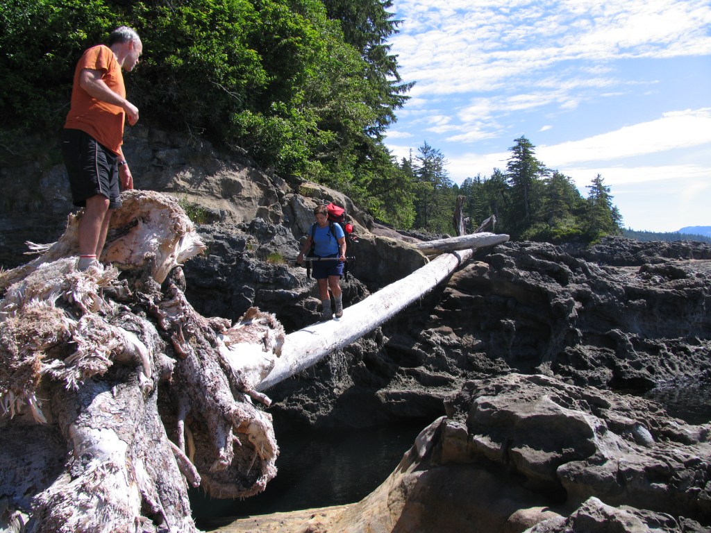
Juan de Fuca Trail (1982 ??, 2007, 2008)
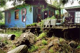
Despite the easier access and proximity to Victoria, the Juan de Fuca Trail (JFT) has a bit of an inferiority complex (undeserved) in relation to its northern neighbour, the WCT. Like most of the coastal trails, the JFT (only 47 kms) is a series of beaches separated by headlands. However, in this case, the headlands are longer, higher elevation, and just as muddy as the WCT and accordingly represent more of a work out. Nonetheless, the three times I’ve walked the trail all bring back fond memories. The first time was a solo venture and my memories are vague (too much weed). I won’t forget however, the community of hippies living on Sombrio Beach at the time. In the late 60s and 70s there was a ‘back-to-the-land’ movement in BC that saw many attempts by idealistic young squatters, social misfits, draft dodgers and the like to build their dream ‘home’ in remote corners of the province. The west coast of the Island was especially popular and over the years I’ve come upon the ruins of many a broken dream, long abandoned ‘cabins’ in wild and often spectacular sites. Once, on Vargas Island, north of Tofino, in the forest and hidden from the beach, I came upon the unlikely remnants of a partially built, modern-day ark, a good 15 m long. Beside it, a forlorn dwelling slowly succumbing to nature. Exactly what the boat builder had in mind and why he abandoned his project, will always remain a mystery.
The community at Sombrio was well established when I visited, some of whom had been there many years. Their eclectic, driftwood ‘palaces’ were a testament to creativity with limited resources. The squatters were eventually evicted with the creation of the Juan de Fuca Trail/Park. Sombrio has since become one of the premier surf beaches on the Island.
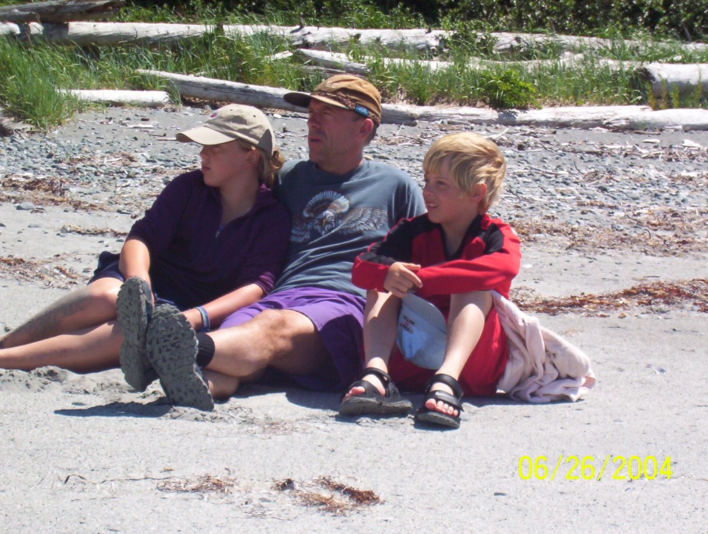
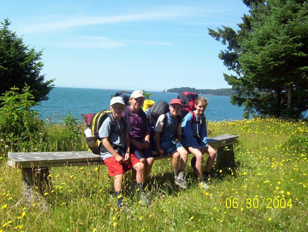
My second trip was as the parent volunteer for my daughter Nina’s, Grade 10 Outdoor Leadership class’s annual hike. The teacher, myself and twelve 15 year olds made for a fun dynamic on the six day hike. It was a fantastic, first experience for most of the kids and not without difficulties as the rough, muddy trail and periods of rain kept things challenging. During one particular downpour, the whole gang kept dry hanging out in a seaside cave. We built a fire at the mouth of the cave and conjured up images of earlier coastal dwellers doing the same.
Early in the hike, at Bear Beach, we used a couple of tarps we were carrying to cover a large, domed shelter we had built using assorted branches and driftwood. Meanwhile, some of the gang fired up a big bonfire with a bunch of football sized rocks at its center. After an hour or so, we pulled the red hot stones out of the embers, gingerly placed them in a pit at the center of our shelter and then all fourteen of us crowded in for a communal sweat lodge. A first for all the kids, they embraced the moment and as the heat built, they were soon chanting like ‘natives’ (at least, their version of). After a good period and everyone with a full sweat on, we poured out of the sauna, clambered over some logs into a nearby, small, freshwater pool for the requisite, cold-water immersion. For those willing to brave it, a thin, waterfall cascading off the cliff above into the pool provided a unique and powerful shower. It was a super cool experience for all involved.
The following year, we convinced our dear friends, Peter & Sheri and their two kids, to join us for their first multi-day, coastal hike. Despite the beautiful weather, it still amounted to a tough hike for the unprepared and a formative experience for their two boys who’ve since gone on to embrace an outdoor lifestyle. Nico, our son, and his buddy Connor rounded out our group of eight.
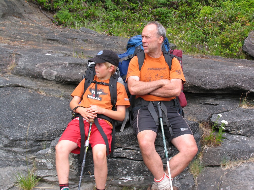
(Left) Like father, like son. (Right) Sheri, a neophyte hiker, braving a log crossing above a surge channel. Gutsy!
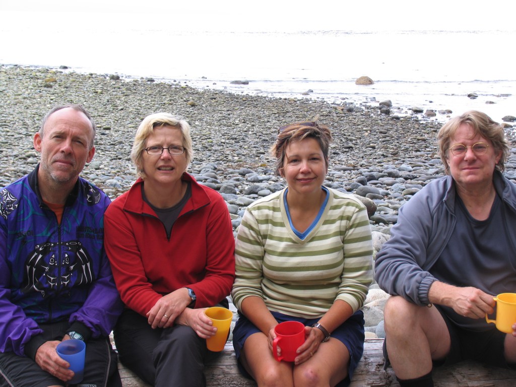
(Left) The adults enjoying a wee tot of well deserved single malt after a long day’s walk with heavy packs! (Right) Our lovely lunch spot on a sandstone shelf alongside a quiet cove.
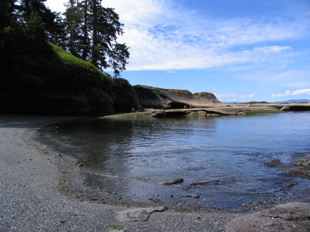
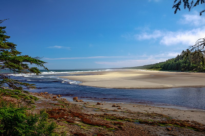
At the north end of the trail, just before the community of Port Renfrew (which also happens to be the southern terminus of the West Coast Trail) is the spectacular Botanical Beach. Not a ‘beach’ at all but a wide rocky shelf, that at low tide reveals a wonderland of tide pools. The pools are thick with inter-tidal life and are a source of endless exploration, a beautiful way to end the JFT.
Botanical Beach (photo credit: aquamarine4)
Naikoon Trail (1981)
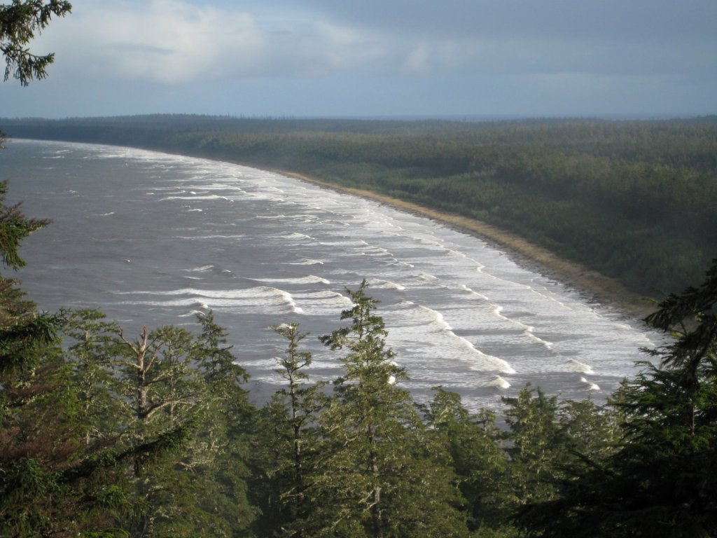
The endless beaches of the Naikoon, also known as the East Beach Trail. (Photo credit: Earth Tracks)
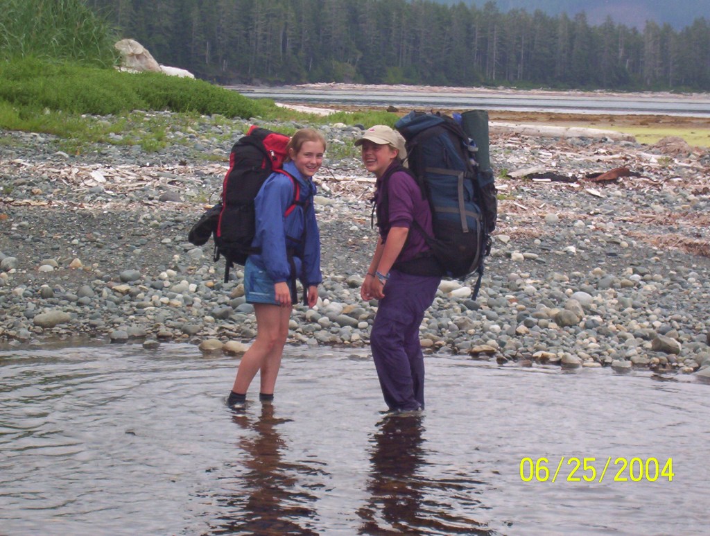
Early in our courtship, I invited Claire to join me on a hike of the Naikoon, her first multi-day hike. This unique trail is an almost continuous beach hike from the tiny village of Tlell in the south to Rose Spit at the northern most tip of Graham Island, the uppermost of the two large islands that form Haida Gwaii. The 89 km hike is not particularly difficult other than numerous river crossings but the weather can be wet. It rained, at least part of, each of the six days of our hike. There was not a soul to be seen the entire time other than a strange, shy young women we met at the mouth of the Tlell River. She was living in a cabin, alone, with her year old baby. She invited us in for fresh baked bannock and during the entirety of our visit she wouldn’t look at us, barely uttered a word.
(Left) Endless beach and then another creek to ford. (Right) An unlikely spot for a blowhole!
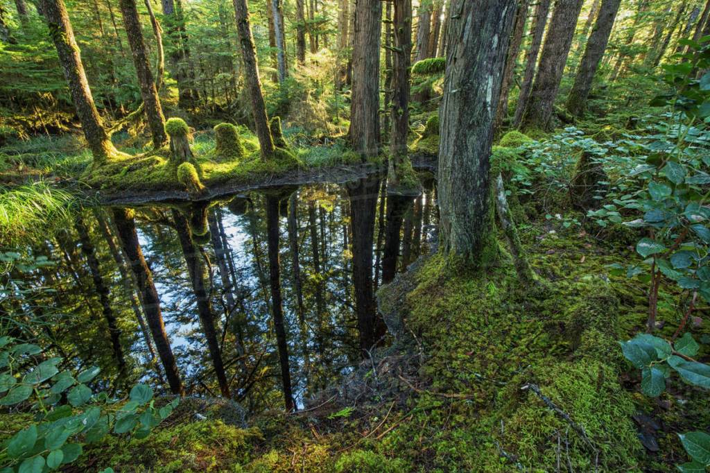
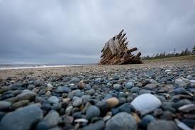
(Left) Magical little ponds in the forest. (Right) The famous wreck of the Pesuta. (Photo credits, clockwise from top left: Wikimedia Commons, Eh Canada Travel, Dissolve, Peak Visor)
One of the highlights of the trail was our furry companion, Zack, the ‘Wonder Dog’. Zack was my brother’s dog and was an exceptional animal. He was a handsome mix of golden retriever, Samoyed and coyote, exceptionally intelligent, loyal and responsive. It was to be his first hike carrying his own food (and some of ours!) in a specialized ‘dog pack’. When we first put it on, he staggered around as though it was too heavy, but then he spotted a squirrel and he was off like a shot. Minutes later, he came jauntily back towards us, not a care in the world, until alongside, he suddenly remembered his pack and slipped into his my-pack-is-too-heavy antics. We didn’t buy into his theatrics and before long, he was moving effortlessly and donning his pack each day without complaint.
Zack loved to chase things. I’m not sure he ever intended to catch whatever he chased, that wasn’t the point! A few days into our hike, Zack gave chase to a deer on the beach that was ‘trapped’ by steep cliffs along the shoreline. The deer, a strong swimmer, soon adopted a tried and true escape strategy by heading straight into the waves and deeper water. Zack, in his enthusiasm followed, only to later regret having to carry and eat, sodden, salty ‘kibble’ for the rest of the hike.
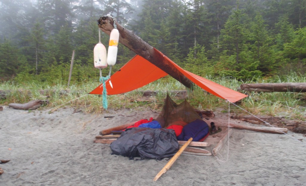
On this hike, we carried only a cheap, blue tarp for a tent with a small square of 6 ml poly for a ground sheet. The wind, rain and cool temps kept the bugs at bay so our bare bones setup worked fine. One night, to avoid a driving wind and rain, we found a flattish spot deep inside the dark, and rather eerie, forest. As I collected wood and got a fire going, Claire, accompanied by Zack for ‘protection’, went to fetch water. Half an hour later, Zack came jogging back into camp with Claire nowhere to be seen. I yelled, angrily “Go get Claire?” He immediately turned and ran to Claire (who had told him to go ahead), then back to me, then back to Claire…..all to demonstrate he had never abandoned her.
The next night, we set up our tarp beside an old A-frame shelter that was clearly mice infested and inhabitable. Behind the shelter were what appeared to be long abandoned pasture land, possibly, we suspected, from the early 20th century attempts at ranching that we had heard about. Zack and I decided to check it out. Not more than a 100 meters in we saw something moving but it was too obscured by bush to identify. I indicated to Zack to be quiet and then I got down low and side by side, using bushes for cover, we snuck up on what turned out to be, one of the ‘phantom’, feral cattle of Haida Gwaii. A shaggy head and wide spread of horns confirmed its ancestry. Given Zack’s love of the chase, for him to obey my signal for stealth was impressive. Then again, a large wild animal with long, sharp horns is not something to mess with.
Not surprisingly, another lasting memory of that hike, as we trudged along, was thinking of a design for more effective rain gear. This was long before $800 Arcteryx parkas and nylon pack covers, in fact Goretex parkas were just becoming popular at the time! We hiked in shorts (to avoid wet, heavy pants) with perpetually wet feet but thanks to the driftwood-littered beaches, an evening fire allowed us to dry out each night. Despite the gloomy and wet images these anecdotes might evoke, it was a wonderful hike and clearly, a bonding experience for Claire and I. Still together and still hiking, 40 years later!
Nootka Trail (2004)
Our walk of the Nootka Trail (35 km) was another stellar hike. Claire, the kids (Nina, 14 and Nico, 12) and I did the 5-day hike with the Haberl family who have two kids the same age as ours and who are close, school buddies. We had perfect weather and our two families were excellent hiking companions. The trail is on the west coast of Nootka Island which forms part of the west coast of Vancouver Island. We flew with Air Nootka (in the classic, Canadian made, float-equipped, Single Otter) from their base at the head of Muchalat Inlet near Gold River, to a sheltered, tidal lagoon at the north end of the Island, about 120 kms north of Tofino. After wading ashore, we donned our heavy packs (the two Dads were way overloaded!) for the short but rough hike through dense old growth forest to the first beach access. As we emerged onto the beach we were greeted to the sight of young grey whales feeding amongst the surf on what we assumed was krill. We made camp right there and marveled at the scene before us.
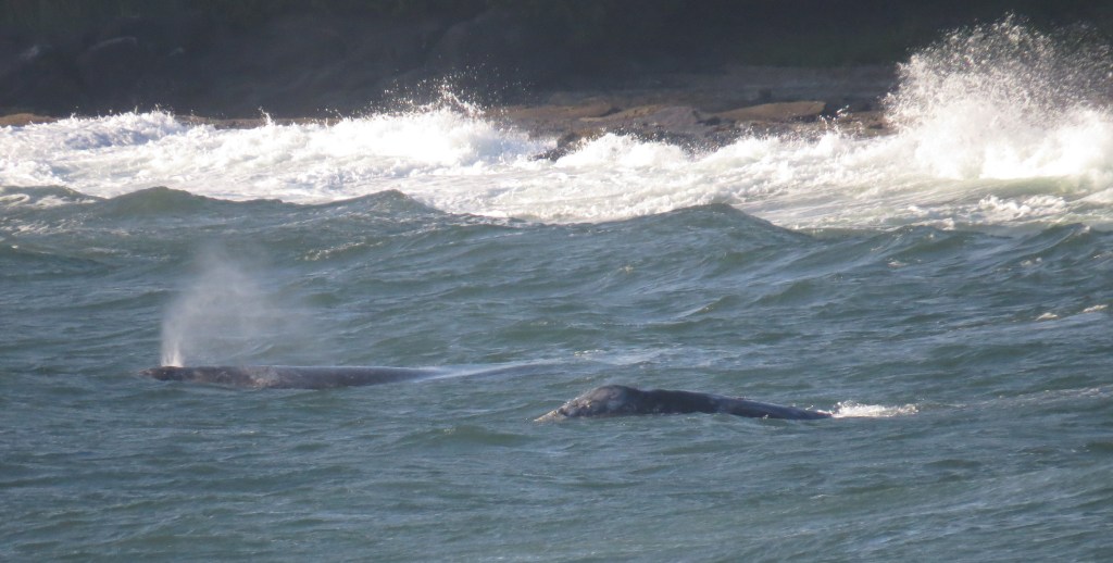
Though grey whales might eat krill while migrating, they are unique amongst cetaceans in their bottom feeding habits of digging up sand and the filtering out small prey like tiny crustaceans, worms, and amphipods through their baleen. This is what they were doing in the photo.
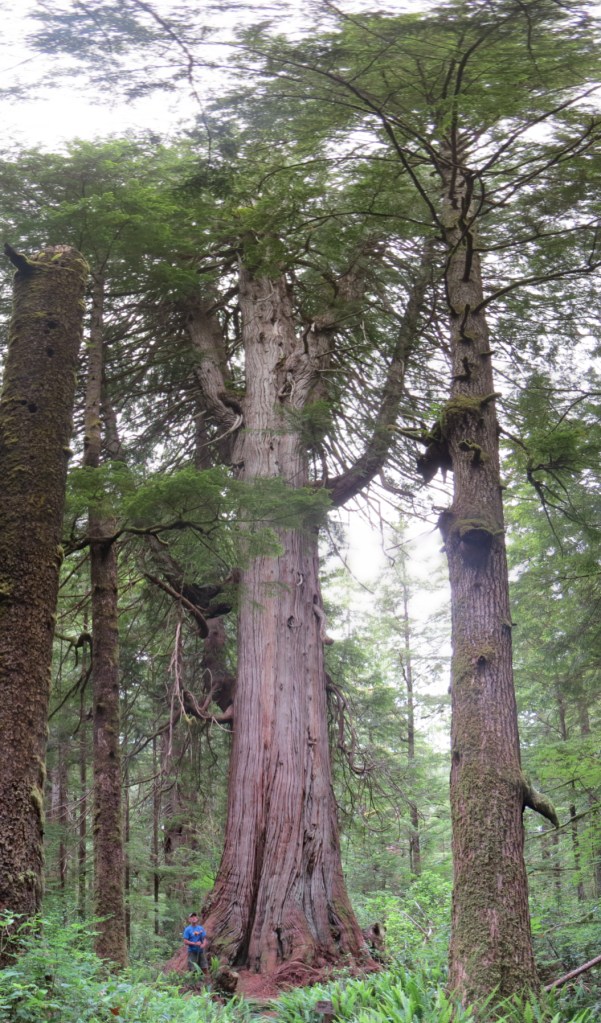
Subsequent days were as magical. Though logging threatens some stretches of this hike, all of the forest portions we walked were untouched, old growth with an abundance of the enormous, gnarly red cedars typical of the coast.
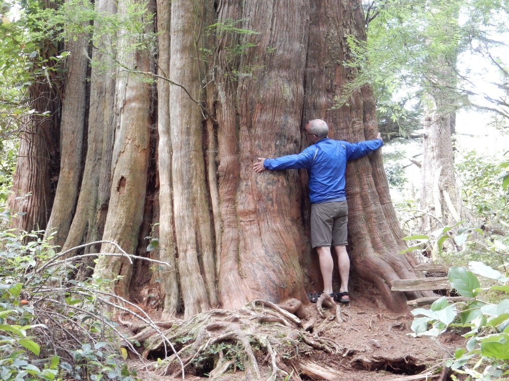
This photo is from a kayak trip into Meares Island, not far from Tofino, but I include it as representative of the kind of old growth cedars once can see along the coastal trails. This particular giant, the ‘Hanging Garden Tree’ has a circumference of 18.3 meters (60′) and a height of 42.7 meters (140′)!
On one stretch of rocky, tidal shelf we came upon a family of wolves. All of us stopped in our tracks but the two girls, out in front and deep in conversation, plowed ahead unaware of the wolves right in front of them. The two adults wolves quickly slunk into the forest with most of the pups hard on their heels but two of the braver, inquisitive pups stood side by side on a log watching with curiosity these two strange creatures walking directly towards them, possibly their first sighting of humans. The yips and yaps of the adults calling their young caught the attention of the girls just as the two wayward pups finally turned and headed to the bush. In the following days we saw more sea wolves, black bear, otters, eagles…all the iconic wildlife of the coast.
(Left) Dad with his favourite hiking buddies! (Right) Non-stop chatter of two 14 year old girls. That’s one big pack for someone Nina’s age!
Though unoccupied when we passed the rocky beach at Beano Creek, a consistent, right-hand, breaking wave just offshore indicated, to our untutored eye, good potential for surfing. The discovery of some rustic shelters up amongst the trees with a few surf boards propped alongside, confirmed our suspicions. We later found out that the break at Beano Creek is well known amongst west coast surfers willing to access its remote location.
Funky accommodation at the surf camp at Beano Creek. (Photo credit: Tatchu Surf Camp). This was a step-up from the rustic shacks that existed when we passed through.
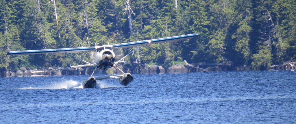
The Nootka Trail terminates in the First Nation village of Yuquot, also known as Friendly Cove. This was the summer home of the famous Chief Maquinna and the Muchalaht people for millennia. It’s also the site of the first contact between Europeans (Capt. James Cook in 1778) and First Nations people in British Columbia. We hung out at this historic and picturesque site for a couple of hours as we waited for the M.V. Uchuck to arrive, a small cargo ship that is the lifeline to the isolated communities up and down the coast, to take us back to Gold River.
(Left) One of our lovely campsites, with easy access fresh water and a perfect swimming hole. (Right)The kids waiting for the M.V. Uchuck at Friendly Cove.
Once on board the Uchuck and underway, I reminisced with Vicki about how stellar our hike had been. As we spoke, and just to add one more highlight to an already exceptional experience, Luna, the celebrated orphaned orca, swam up to the ship. Luna, born in the Puget Sound, was a member of the Southern Resident Killer Whales’ L-pod. Somehow Luna got separated from his pod while feeding in the Nootka Sound. Lost and lonely, Luna eventually sought out human contact and became known for his ‘inter-species interactions’, attracting wildlife enthusiasts from around the world. Attempts to reconnect Luna with L-pod degenerated into acrimony amongst the interested parties and was ultimately unsuccessful. We were largely unaware of all the controversy at the time and were delighted to meet this famous orca. For the next twenty minutes, as we motored up the Muchulat Inlet, Luna entertained all aboard with jumps off the bow wave, upside down swimming and other antics. It was a one of a kind display of a born entertainer. Sadly, a few weeks after our encounter, Luna was killed when sucked into the propeller of a powerful ocean going tug. Her attraction to humans was her downfall.
North Coast Trail (2006)
Another stellar adventure, we did this hike as a family, the same year the trail was officially opened. With a total length of approx. 60 kms, the hike starts with a water taxi drop off from the north Island town of Part Hardy to the isolated Shushartie Bay. As the taxi, idled out in the bay and started the shuttles to shore we couldn’t help noticing the three black bears feeding in the estuary at the head of the bay. We had also heard that a grizzly had recently been sighted in the bay. Grizzlies are not endemic to the island so this was interesting, if not slightly disconcerting, information.
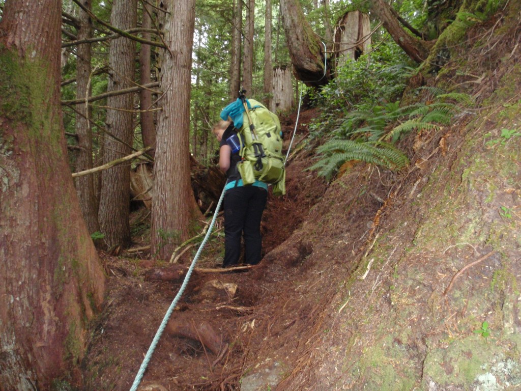
The first day’s hike to Skinner Creek, considered the longest and hardest day, was a rude awakening. It was also an introduction to a unique environment, so different from the rest of the Island. Small diameter, cedar trees dominated the ‘old’ growth forest and the ground was covered in mosses so thick you could plunge an arm in without finding bottom. The trail was only lightly trafficked and work was still underway to boardwalk sections that would become mud bogs with more use. Planks and stringers for the boardwalk were being flown in by chopper and, to be expected, funding shortfalls limited progress. As a long time trail builder, all the immediately accessible, dead and down cedar was, in my mind, perfectly good and MUCH cheaper building material. I’m sure the demands of BC Parks out of their concern for environmental impacts, limited that economical approach. Whatever the case, the trail was rough and hard going. We were all bagged by the time we pulled onto the beach at Skinner Creek.
(Left) The drop off shuttle, two at a time, in the water taxi’s tiny tender. (Right) Hauling on hand lines. The abrupt and rough start to the hike.
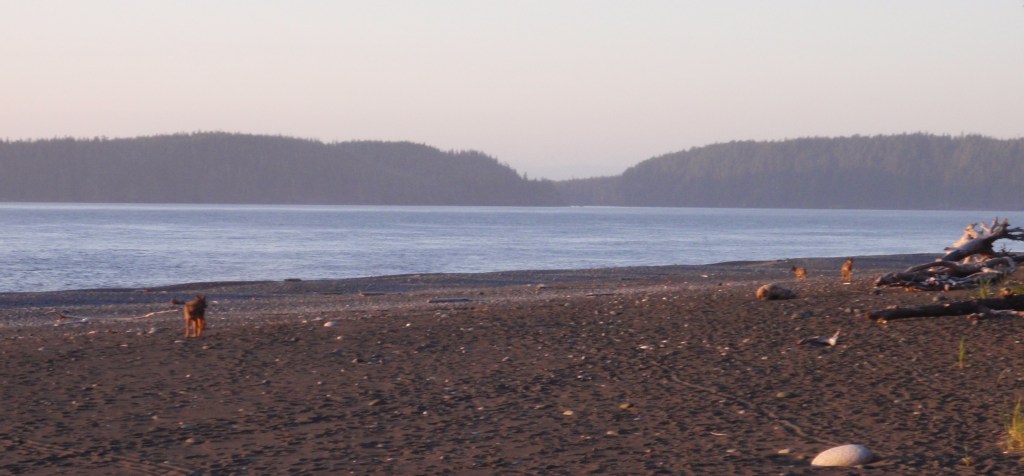
At our first night’s campsite we were visited by three wolves! They were heading west on the beach but turned back when they came upon us. In the background is Hope Island and the entrance to Bull Harbour, an important anchorage at the west end of Goletas Channel. From here to Cape Scott is open water exposed to the full force of the Pacific.
The kids watching the wolves but sticking close to the fire, not quite sure what to think of our 4-legged visitors. We camped, one kid in the tent with Claire and the other under a tarp with me, alternating kids each night. It took some doing to convince Nina to join me that first night under the tarp, open to the wild!
At one of our beach camps, we were kept up late into the night listening to the powerful exhale of whales surfacing just offshore. The Goletas Channel is part of the annual grey whale migration, en route to their summer feeding grounds in the Bering Sea. Falling asleep to the sound of whales breathing was a wonderful experience unlikely to be repeated.
It was rough going on the trails through the dense forest. The trail would head into the forest when skirting impassable stretches along the coast.
It was easier going on the beaches though hiking with a full pack on soft sand can be a struggle!
Despite the persistently wet environment, finding fresh water can often be a challenge on coastal trails. Accordingly, camp spots are typically adjacent to a water source and can be few and far between. Despite this scarcity, we camped alone each night but one, that we shared with another group of four adults.
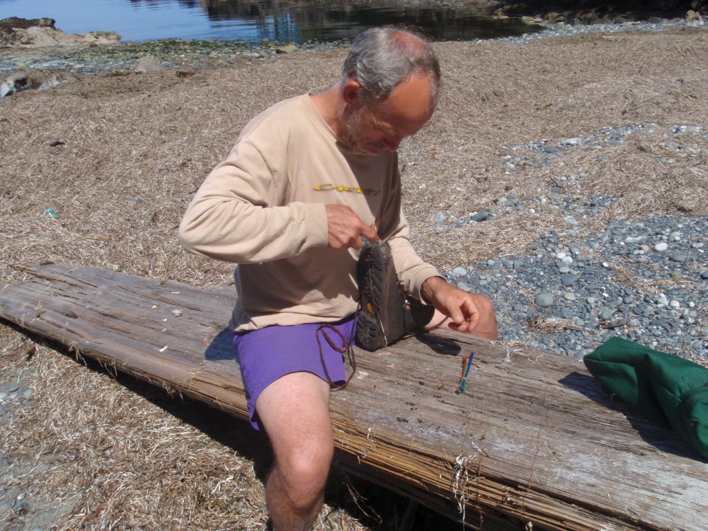
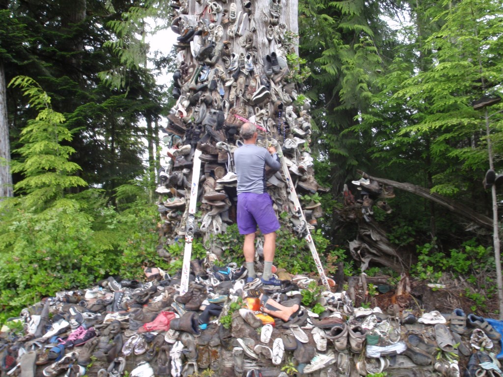
(Left) Repairing my old hiking boots using zap straps to hold the sole on. The repair sufficed until the end of the trail. (Right) Hanging my boots on the infamous ‘shoe tree’. There is a long standing tradition of hikers leaving their worn out footwear, victims of the muddy Cape Scott Trail and now, the equally tough-on-footwear, North Coast Trail, on this roadside tree.
Our last night on the North Coast was spent with all of us under the tarp. This convenient log made set-up easy. The kids were by now comfortable with this exposure to the elements.
Hesquiat Trail (2019)
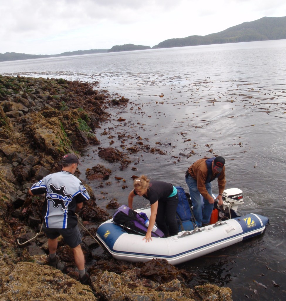
Another beautiful and remote, fly-in/fly-out, trail. We did this shortly after first hearing about it and as expected, we met only 2 other hikers on the 6 day trip. The flight in was from Air Nootka’s base at the head of the Muchulat Inlet. The classic, float equipped, Beaver dropped us in some ‘reasonably’, protected waters at Escalante Point. Air Nootka failed to mention that a few days prior, when landing at the same spot, the pilot failed to note the ocean swell that was coming from an atypical direction. As the plane touched down, it bounced off the swell and came down so hard, it drove a stay right through the wing and one of the pontoons. The pilot with his passengers, 2 hikers and their 2 dogs, waited on the disabled plane, now slowly sinking, for rescue to arrive. Luckily, a local Search & Rescue team was in the area on a training exercise and were able to get to them just as the plane sank in the shallow waters. That same evening, when the tide was at its lowest, a heavy-lift helicopter from a local heli-logging operation came in, picked up the plane and returned it to their base. Without a doubt, that old stalwart, the de Havilland Beaver, is back flying the coast. We met the 2 intrepid hikers the day after our drop off and they recounted their harrowing story. They had returned to Air Nootka’s base in the chopper (to dry out and recover) and had then taken another flight to Escalante later on the day we were dropped off. They had come all the way from Ontario to do this hike and a plane crash wasn’t about to put them off.
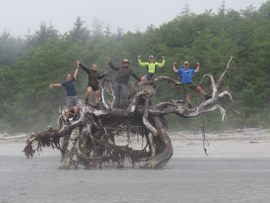
(Left) Brother Dave, with a fresh sockeye sticking out of his pack. (Right) The ‘gang’ on an impressive root ball. From the left, our good friends Richard & Ruth, Dave, Claire and Jim.
Our landing was smooth. The plane motored to the beach and we were able to jump off the pontoons directly onto the beach. Much to our surprise and pleasure, a group of local First Nations were camping on the beach. They had been fishing and after a nice chat they gave us a fresh sockeye salmon they’d caught that morning (see photo above) and sent us on our way. Two hours later, we stopped for lunch. I got a fire going. Dave filleted the salmon, in an instant, and before you know it, we were feasting on fresh salmon! It was something about the unique circumstance, the beautiful day, the awesome locale and the freshness of that salmon that combined to make that the best fish we have ever eaten!
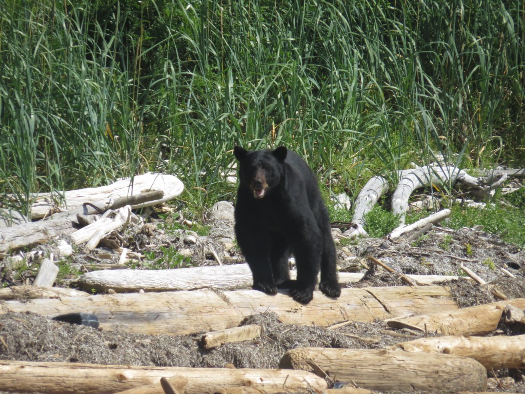
Black bears are a common, and always delightful, sight on coastal hikes. They can however soon become a problem if conditioned to human food. An infamous bear on the JFT adopted the stratgey of approaching hikers while their packs were off . The hikers would back off and the bear would quickly drag their packs (and food supplies) off into the bush!
The 50 km Hesquiat Trail is the easiest of the coastal hikes, in that there is very little elevation gain as the trail sticks to the coast but the varied footing could be a challenge. At times beach walking, then stretches of intricately etched, sedimentary rock, tidal shelves and at other times, large boulders that one carefully hops from one to the next. At one point, the mesmerizing focus of rock-hopping had us switching to balancing along the haphazard piles of driftwood logs at the high tide line. Somehow this seemed easier!
On day three, we arrived at the Estevan Point Lighthouse. This 30 M tall lighthouse established in 1909 is one of the most important, navigational and heritage structures on the coast. The immaculately kept grounds and buildings were in stark contrast to the wild nature that surrounds it. The keeper was the sole occupant and clearly valued the opportunity to chat with us random hikers, which I suppose, was a measure of how few had come through that season. The following day we passed through the Hesquiat Indian Reserve. Only one family was living on reserve and they also, were keen to engage. They served us some tea and then brought out some artwork for sale. The lack of traffic ensured negligible business but Richard made their day and purchased a small piece. Both encounters were very pleasant and unexpected.
We had heard about Cougar Annie’s garden in Boat Basin (located near the end of the trail) prior to setting out on the hike but we were quite unprepared for what awaited. The story of Ada Annie and the garden she created is the stuff of legends. The four husbands and, some say, their mysterious demise, is just one of many. The eight children she bore and raised in this remote location, is another. Then there is the over 50 cougars she shot for bounty and to protect her goats and chickens. The official post office she established using subterfuge that’s sole purpose was to support her mail-order nursery business. Let alone, the story of creating her 5 acre garden out of the prodigiously fertile and overwhelming, temperate rain forest….and the list goes on!
After her children moved away during the 1940s, the garden slowly reverted back to rainforest. Annie departed her beloved garden for the final time in 1983 and died two years later, days short of her 97th birthday. Against all odds the garden was restored, a process requiring over thirty years of hard work. And here, begins the tale of Peter Buckland. Peter, a retired investment banker and ex-Olympian (Field Hockey for Canada) had befriended Annie in the late 60s and eventually bought her property in 1981.
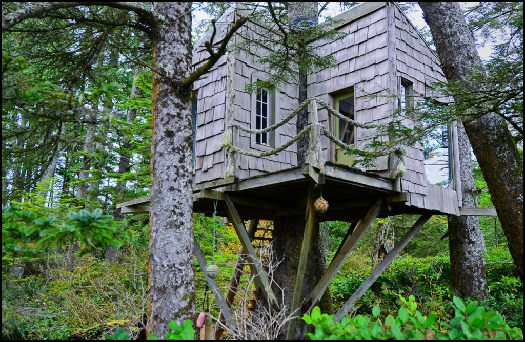
We were thrilled to meet Peter when we arrived in Boat Basin. He is gregarious, energetic, intelligent and a wonderful host. He first sent us off on a trail through a spectacular stand of old growth cedar with a promise to take us on a tour of Annie’s garden when we returned. The tour was a two hour wonder. One incredible, creative structure after another, all built with locally-harvested cedar, some milled but primarily ‘split’ cedar (we saw one 4′ x 7′ x 4″ thick door consisting of a single slab of split cedar without a knot!), all with a tale attached and all in this stunning west coast environment. There were tables 4′ wide and 30′ long cut out of single pieces of yellow cedar. A lecture hall with revolving lectern on a cliff overlooking a pristine lake. A communal kitchen, a dining hall, even a museum. Funky treehouse accommodation for visitors. Much of the dispersed site connected by elevated, split-cedar walkways that meandered through the untouched, old growth forest and random rock formations. The labour of love to create all this, in this remote and isolated location, was the work of Peter and friends, over 30 years and an estimated 38,000 hours of volunteer labour. To what end, you may ask. As of our visit, this remarkable place (a perfect environmental education center?) was unused. We subsequently learnt that disputes over its future had developed with some members of the local First Nations but we hope these are now resolved and this wonderful place reaches its potential to positively impact all who visit. The description above barely touches on how singular the experience our visit was. To find out more, visit the Boat Basin Foundation’s website.
(Left) A bald eagle, sheathed entirely of split-cedar, shelters the firewood stored below. (Right) Cougar Annie’s home, post office and a small portion of her garden. Keeping nature at bay in the garden was an endless task! Our lack of photos must reflect how enthralled we were.
(Left) Our last night on the trail. We sat around the fire trying to make sense of what we had just seen at Cougar Annie’s. (Right) One of the giant cedars, a short walk from her garden. How she and her husband(s) managed to clear the land is beyond me.
The Beaver floatplane landing on Hesquiat Lake to pick us up for the return flight to the Air Nootka base at the head of Muchulat Inlet. Typical of flying these ‘bush planes’ in the rugged wilds of Canada, the flight was anything but ‘typical’. We had to circle twice to clear a mountainous ridge and our landing on a narrow arm of the Gold River in a strong crosswind was, at least, from a passenger’s perspective, quite sketchy!
The Tatchu Trail (2020)
The Tatchu was our latest coastal hike. It is also the most recently ‘developed’ or, at least, known about by the broader public. It was just Claire, myself and brother Dave on this trip. Though not particularly long or hard, getting to and from the respective trailheads is logistically challenging, both requiring boat or plane access. We decided to kayak the 22 kms from Fair Harbour to Rugged Point, stash the boats and just do an out & back hike of the trail. Other than fighting a headwind on our way to the point, both the out & return paddles were well protected and scenic.
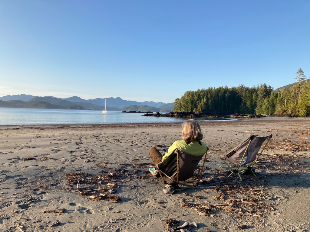
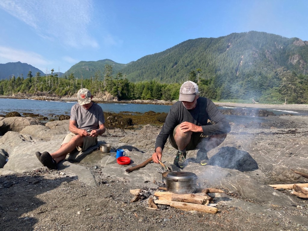
(Left) Our first night at Rugged Point Marine Park. These light weight chairs, that Claire is on, are a Godsend for us older folks and are easily carried when on a kayak trip. We left them behind, stashed in the kayaks, when forced to carry everything on our backs. (Right) Dave is a skilled camp cook and his non-stop energy (ADHD, for sure!) results in some fine dining on the beach.
The hike itself has all the charms and variety one comes to expect of a coastal hike with beautiful beaches, rocky stretches, rich intertidal zone, off shore islands and the usual coastal mammals. Also, and despite its remote location, a lengthy, series of logging roads away from the nearest town of Zeballos, there are a couple of private landholdings with what appeared to be a fishing resort being built . As we scrambled up and over an ugly, rock jetty extending out from what was once a beautiful little cove, one couldn’t help wondering how they got approval…or did they?
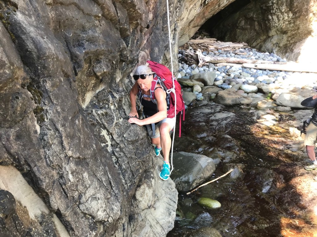
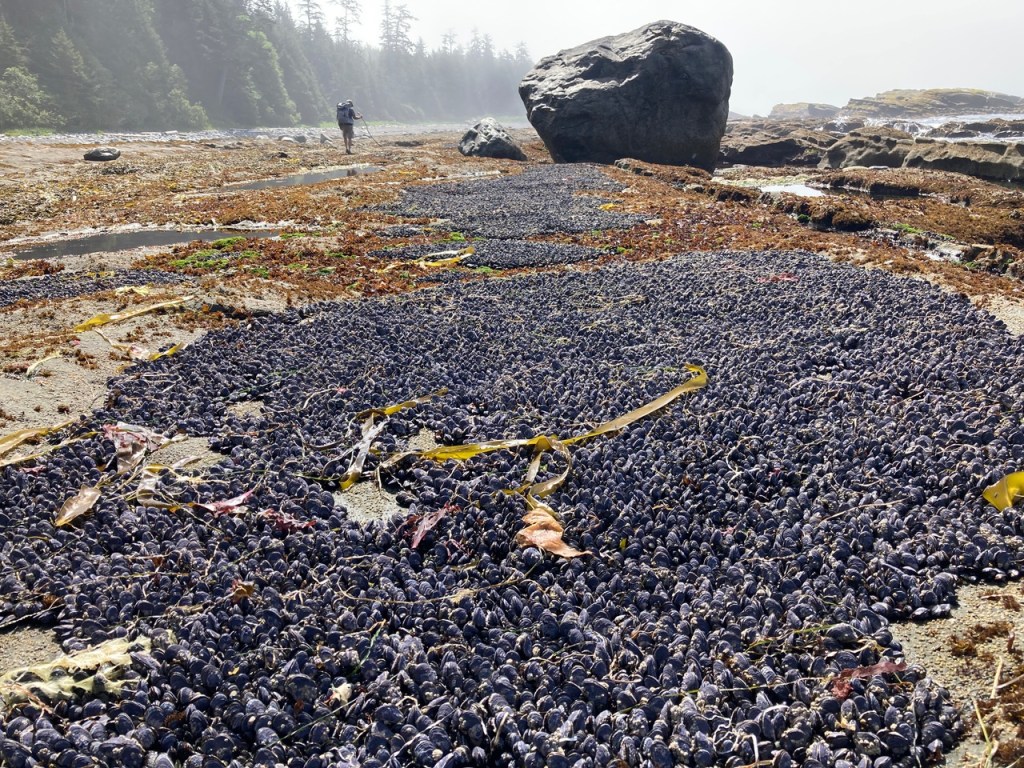
(Left) Claire navigating a tricky section of trail complicated by the rising tide. (Right) A bed of mussels reflects the rich bounty of the coast. No wonder the coastal native culture(s) had such rich artistic traditions. Their productive environment provided them the time and energy to express themselves artistically.
As we get older, donning a multi-day pack becomes more of a challenge so slowly, but surely, our preference now for coastal explorations is by kayak. Maybe one of these days I will want to recount some of the wonderful kayak trips we’ve had on the BC’s rugged coast, a coastline stretches for an awe inspiring 25,725 kilometres! Tales for another time.

I get exhausted just reading this! Far too much for an old lady! Wonderful memories for you!
Love and hugs, Alice
XXX000
1 Wonderful memories for you to have!
LikeLike
Great to hear from you Alice and thanks for commenting. Were you ‘exhausted’ by the length of the post or the perceived difficulties of coastal hikes? 😘
Yes, lots of wonderful memories that I wanted to write down before we forget them!
Love
Jim & Claire
LikeLike